Skip to content

GIS & Asset Management

At Project Delivery Managers Pty Ltd, we provide a range of asset services for both private and government entities.

Operate · After dark in the project day

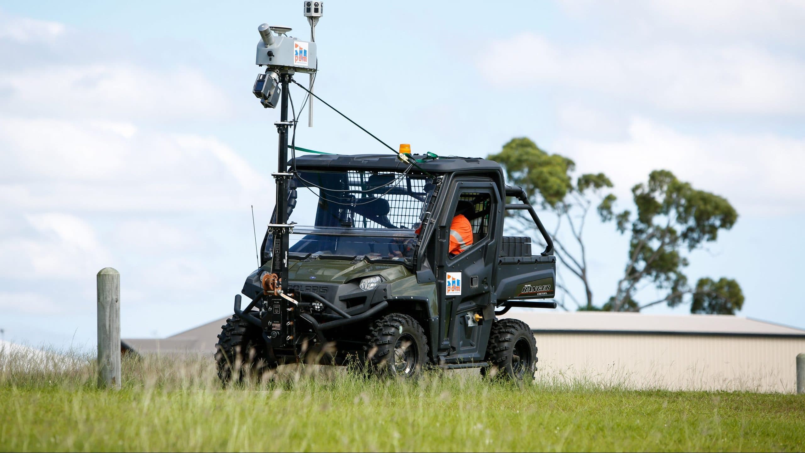
All-terrain vehicle carrying PDM’s mast-mounted LiDAR scanner and cameras
  1. DevelopFirst light · Advisory ServicesStrategy, feasibility and business cases
  2. DeliverFull sun · Project ServicesProject, program and construction management
  3. OperateAfter dark · GIS & Asset ManagementAsset capture, LiDAR, GIS and LAMS

Asset management is the practice of managing assets to achieve the greatest return (particularly useful for productive assets such as plant and equipment), and the process of monitoring and maintaining facilities systems, with the objective of providing the best possible service to users.

PDM has in-house GIS specialists that utilise a range of asset collection tools from laser scanning to high-definition imagery capture to assist in the information gathering and measurement of assets.

PDM’s Laser Asset Measurement System (LAMS) utilises one of the most versatile LiDAR systems on the market today and current high-definition imagery capture devices for the delivery of high-density point clouds and colour geo-referenced imagery.
Service areas

  • Asset Management
  • Imagery Capture
  • LAMS Asset Capture

Capabilities

  • GIS (including Technical Support)
  • Application Development – Desktop, Web & Mobile
  • Enterprise GIS Implementation
  • 3D Visualisations & Simulations
  • GIS Data Creation & Analysis
  • Remote Sensing & Topographic Data Collection
  • Technical Support
  • Asset Planning
  • Asset Imagery (PDM LAMS)
  • Laser Scanning (PDM LAMS)
  • Needs Assessment & Business Process Reengineering
  • Desktop, Web & Mobile Mapping
  • Building Information Modelling
  • Database Design & Maintenance

Imagery capture

Laser scanning

PDM’s LAMS System’s versatility is in its capability of easily being fitted to either a standard road vehicle, all-terrain vehicle (ATV), train, boat or aerial platform, which truly stands out from other mobile units. PDM additionally have the flexibility to either front or rear mount the scanner on both a standard vehicle and ATV. This provides for fast and safe collection of LiDAR data in all environments.

At PDM, we utilise a forward-mounted scanning system to capture gravel roads, ensuring the best quality imagery is obtained. Further versatility is provided with PDM’s scanning system having the capability to provide static scanning by utilising a Faro Focus 3D scanner for high density of static environments. This delivers to our clients unparalleled flexibility of both mobile and static scanning solutions.

In addition to a versatile scanning system, PDM’s scanning team has a strong background in engineering and modelling. This gives PDM the edge in delivering a product suitable for its intended task, as there is first-hand knowledge in how the data can be utilised in new and existing workflows.

Laser and imagery capture

PDM utilises a range of equipment and methods of scanning to best suit the objectives of our clients and the environment being captured digitally. PDM’s LAMS platform is extremely versatile, able to be mounted on a range of vehicles in various configurations to suit the environment being scanned. This includes:

  • Road vehicle (forward or rear mounted)
  • ATV
  • Helicopter
  • Boat
  • Rail

In addition, for high-density scans of static environments PDM utilises a Faro scanner to complement the mobile scanning equipment.

Applications of LiDAR scan data

The output of PDM’s LiDAR scanning systems can be utilised in an ever-increasing number of applications such as:

  • Ground/Surface Modelling
  • Asset Management
  • GIS/Mapping
  • Historic/Heritage Data Capture
  • As Constructed/Built Modelling
  • Reverse Engineering
  • Modelling for Movies/Games/Simulations
  • Volumetric Analysis
  • Flood Modelling
  • City Planning

The field is rapidly evolving, with new applications being realised as the full potential of reality capture is unlocked across a variety of fields.

LAMS asset capture

PDM’s survey-grade, high-definition mobile video equipment is ideal for councils to measure and view their roads with precision and clarity. The demonstrated benefits regarding this technology are the rapid capture and assessment for DRFA claims and asset condition assessments that is accurate and repeatable.

In Queensland, the Queensland Reconstruction Authority (QRA) has been born to manage the State Government interest in controlling finances to councils for disaster relief. This has seen techniques for assessment and technologies that vary significantly. PDM is leading the way in North Queensland with its mobile mapping system by providing councils with accurate data that QRA insist be provided as evidence for any damage claim on council assets.

Past works – PDM LAMS system

We have previously undertaken asset imagery for the following clients:

  • Burdekin Shire Council flood repairs NDRRA 2010–2014
  • Charters Towers Regional Council NDRRA 2010–2014
  • Hinchinbrook Shire Council NDRRA 2009–2013
  • Flinders Shire Council NDRRA 2010–2015
  • Torres Shire Council NDRRA 2010–2012
  • Cloncurry Shire Council NDRRA 2012–2014
  • Townsville City Council NDRRA 2009–2013

See the capture at work

Laser scanning capability sheets

Published in 2017 for rail corridors, open spaces, aerodromes, buildings and roads.

GIS & Asset Management in practice

All 7 projects
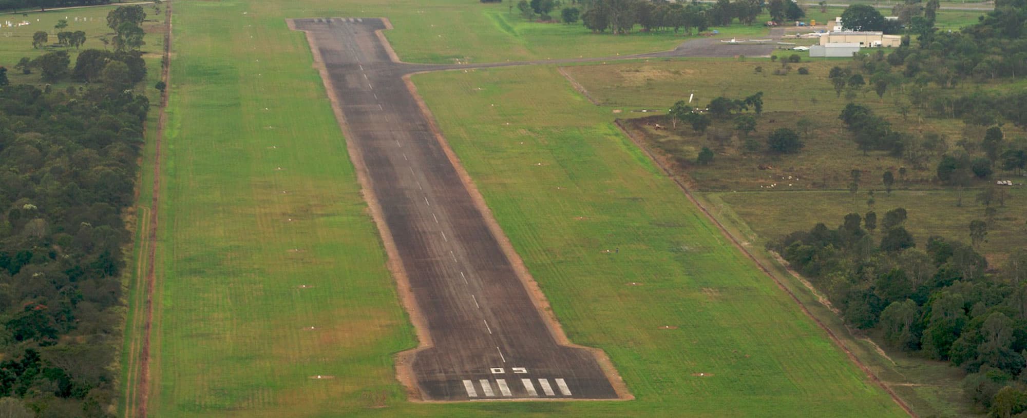
Aerial view of the Ingham Aerodrome runway
Client
Hinchinbrook Shire Council
Sector
Aviation & Ports
Phase
Deliver

Ingham Aerodrome – Pavement Refurbishment

PDM prepared a summary report on the pavement condition of the Ingham Aerodrome, then undertook the project management for its pavement refurbishment.

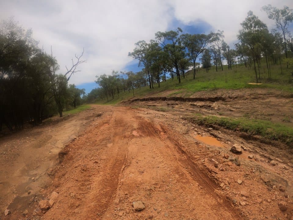
Flood damage on Burdekin Road: a rutted, scoured gravel surface
Client
Charters Towers Regional Council
Sector
Disaster Management
Phase
Deliver

CTRC 2021 Disaster Recovery Funding Arrangements (DRFA)

PDM provided program management for CTRC’s DRFA works, which involved assessing 3,850km of shire roads and reconstructing approximately 1,300km of road.

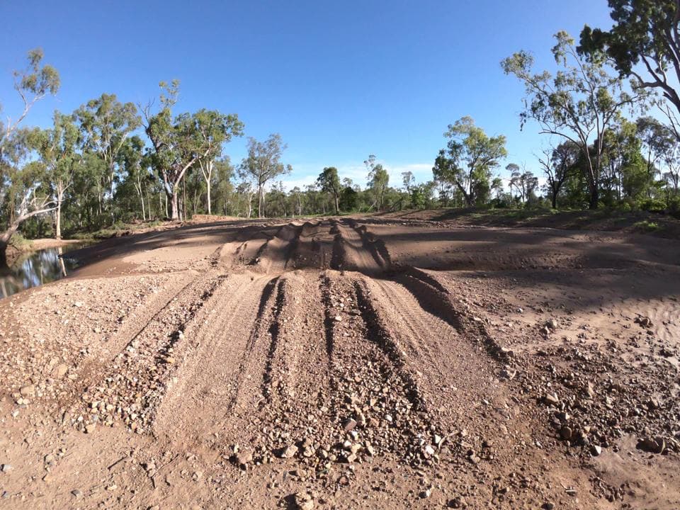
Flood damage on an unsealed road: rutted gravel and wheel tracks
Client
Whitsunday Regional Council
Sector
Disaster Management
Phase
Deliver

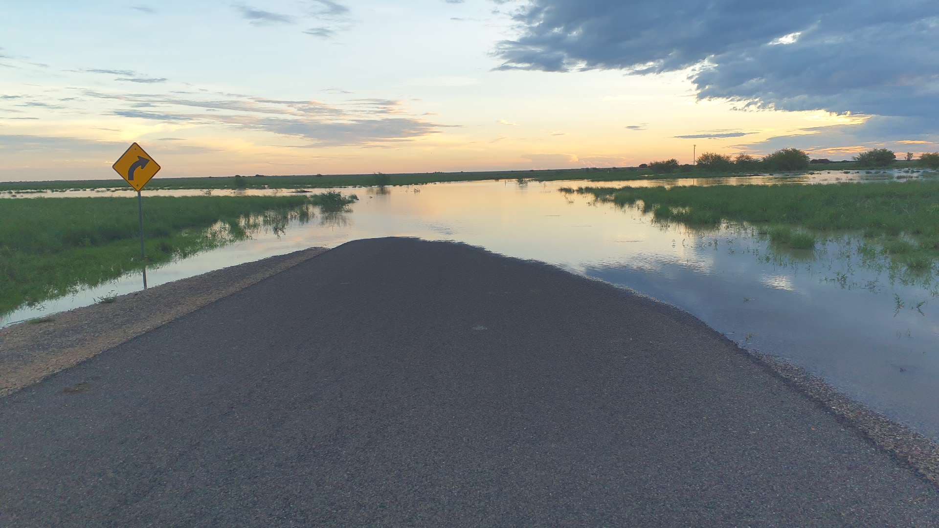
Whitsunday Regional Council – DRFA

As Council’s program management consultant, PDM oversaw the implementation of NDRRA/DRFA flood and cyclone damage remediation works for Whitsunday Regional Council.

Talk to the team about your project.

Call the Hermit Park office, email the team or send an enquiry. Accreditation and policies are on the About page.

Phone07 4772 0402pdm@pdmanagers.com.au

Level 1, 134 Charters Towers Road, Hermit Park QLD 4812

Send an enquiry